The Most Important Things to Consider in Purchasing Hunting Land
written by Blaine Covington
Quality and Abundance of Wildlife
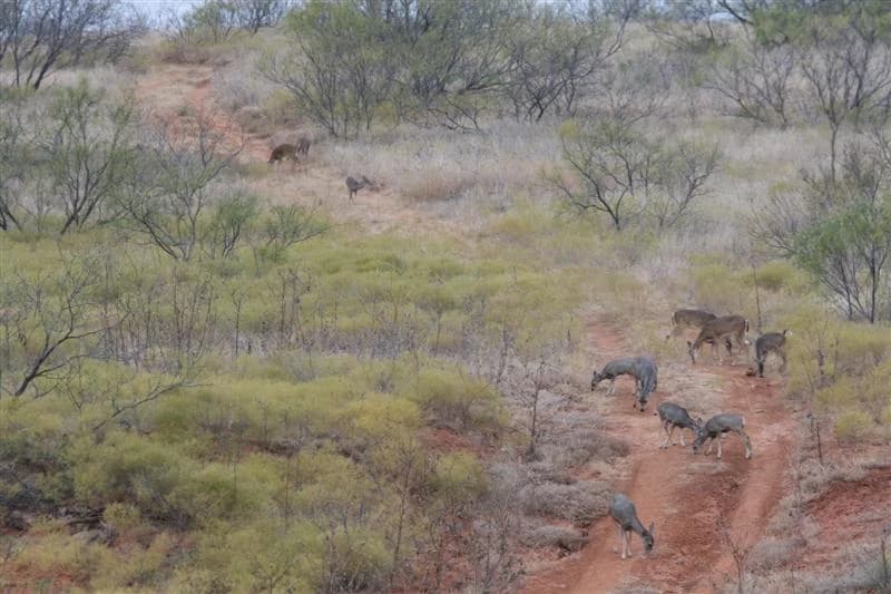
Quality and abundance of wildlife is what most people want and it is probably the hardest thing to determine. The ways of researching the quality of wildlife are: Ask the seller. You may get an honest answer and you may not. However, some landowners who are selling their land don’t know the difference. Find out who has hunted the land before. If it is has been leased for hunting, get the name and phone number of the people who had leased. Call the local Texas Parks and Wildlife Department (TPWD) Biologist since they can be a valuable resource. In addition, the local game warden can be helpful. Ask the neighboring landowner if they hunt or lease their land. If they lease, then contact the people who lease their land. Most people who hunt will try to help each other even if they are absolute strangers.
Water
Water is a broad subject and is important to people in different ways, including: If you are a waterfowl hunter, you want an abundance of standing water in the fall and winter whether it is a lake or stock tank - an example with Wetlands Reserve Program WRP acreage. However, if you are a deer hunter, you would trade a dozen lakes for a good creek or two running through property or along a river - see our Texas ranches for sale with river frontage. The best of both worlds is a lake with a creek or two. Tracks with a lot of developed water are hard to find and is usually reflected in the price. Water for a house or cabin is also important. The things you need to ask the seller are: Does this property have water well? Are the neighbors on rural water or do they have water wells? How far is rural water? What is the cost of bringing rural water to the property? How deep is fresh potable water? Most of the time, the seller can answer these questions. You might need to contact the county’s Cooperative Extension Agent and ask them about water availability. In addition, the local Farm Service Agency Administration is usually very knowledgeable about water availability. This agency can be found at the local United States Department of Agriculture NRCS office, which is located in the county seat of most every county in Texas.
Terrain
To most people, terrain is a major factor in choosing hunting land. Again, what you hunting will usually depend on what type of terrain you want. You can have too much of a good thing for quality wildlife production, so there needs to be a balance. The last TPWD seminar I attended on quail hunting, they said that cactus is great for bobwhite quail nesting. In addition, cattle grazing should be managed as to not disrupt forb production. We will discuss this later on when we talk about leasing grass rights for grazing. If a place has a lot of elevation change, it can make the land more scenic. In some parts of the country there is not a lot of elevation change but this still can be excellent hunting country. You don’t need elevation for quality wildlife production including trophy deer and quail.
Neighbors
Neighbors can be the most important thing to consider when buying new land. In some cases, it should be the first thing to govern your choice. However, this is one of the hardest things to thoroughly research without knowing the area. The things I recommend are:
- Ask the seller
- Get the names of neighbors joining the property you are considering purchasing and call them to ask if they have leased their land for hunting or if they hunt it themselves. Find out if they know of any problems with any of the other neighbors.
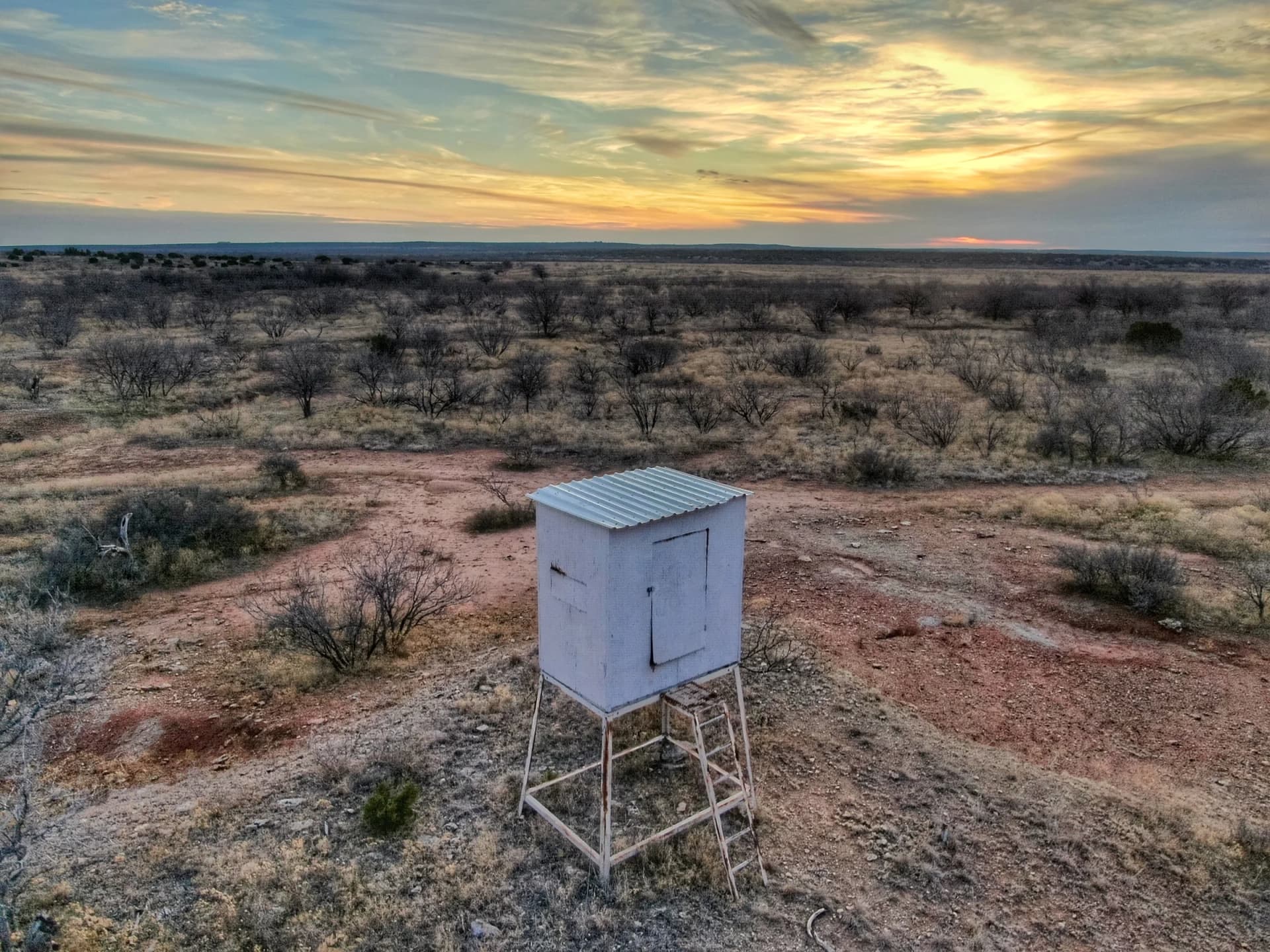
- Look for deer blinds on property lines. This nearly always creates potential problems for buyers.
- Call the local sheriff and ask if he has had any trespassing complaints from current landowners in the immediate area.
- Ask the local game warden about trespassing problems on the land. This may seem like a little trouble, but could save you many problems in future.
A good example is a man whom I sold a place to in Archer County two years ago. He looked at the land and nearly all questions pertained to the neighbors. He asked about every place that touched this property. I satisfied him and after one hour of looking, he asked what price I wanted, and he bought it. At this point, he told me why the neighbors were the most important thing to him. He said he had owned a place in Erath County. When he bought it, there were nothing but big ranches around him. Someone bought one, and divided it up. All of a sudden he had people all around him. One had a bunch of dogs and they chased his cattle and every deer in the area left. He talked to his neighbors but it didn’t do any good so he sold his place. After this experience, his main concern was the history of area and the neighbors. He is extremely happy now and has no worry about neighbors.
Access to Property and Easements
This can be important if you are going to build on your property. Sometimes all weather roads will mean a lot when you are driving to a house or cabin. In dry weather, it is hard to really know how bad the roads can be. This is another factor you should inquire about from the seller and also the neighbors. Some people want more than one access road along with county road or highway frontage. On the other hand, some people would want the county road to dead end at their gate with no access from any side. The reason is the poaching and trespassing problems you can have with easy access. If it is easy for you to access from more than one direction, then a poacher also has his choice of entry and exit points. Easements are important. You want to have a recorded easement if you have to go through someone else’s land to reach your property. There are two different kinds of easements, “EXPRESSED” and “IMPLIED.” An EXPRESSED EASEMENT is one that is recorded in the deed records in the county clerk’s office in the county the land is located. This is sometimes called a “deeded easement.” An expressed easement is the kind you want to have if you pass through someone else’s land to get to your property. The other type, an IMPLIED EASEMENT, is just what it says. It is an easement where access has been granted or earned through use of a road for a period of time. The law governing this type of easement is very complicated and I recommend that you consult an attorney that has had considerable experience with easements.
Minerals and Oil Production
First, let’s talk about current producing wells located on the property. Oil wells are something that some people will be adamant about not having on their property. Don’t let this be a “deal killer.” If you find a place with all the other things you like, remember that the wells won’t produce forever. An example of this is a place in Young County. It was a great place with hardwoods, a good creek, lots of turkey, and much more. I heard it was for sale before it went on the market, so I looked at it. The price the seller wanted was $220 per acre cheaper than I thought it should be. When I opened the gate, I saw why: There were old, shallow oil wells all over the property. Most were leaking, and the place had lots of old buildings, scrap metal, old, rusted tanks, and all kinds of fallen wires. I saw two 140-class buck and several smaller bucks, but I never thought about the deer for the mess. This place sold for $1,450 per acre but it should have brought $1,700 per acre. The buyer eventually cleaned everything up and he now has a great place that he bought for less than market value. The regulatory agency that controls oil production in Texas is the Texas Railroad Commission. If you have any trouble, you can always report problems to them. Some original mineral leases have several clauses in them concerning the day-to-day operation of oil producing wells. If the wells were drilled a long time ago, there may not be anything to protect you as the surface owner in the original lease. An example of things that are written in several leases today is any employee of an oil company cannot carry a gun in their vehicle. This will keep them from hunting. If your property has oil production, you need to make friends with the pumper and let them watch the property for you. The next thing I would like to cover is minerals caps.
- Everyone would like to own 100% of the mineral rights on a property. This is nearly unheard of today. Because of “mineral pros” (people who speculated on mineral rights, back in the 30’s and 40’s), it is very hard to own mineral rights. You don’t have to own all the minerals to be protected from someone drilling a well on your property. An example would be you owning a 1/8 undivided interest in the mineral estate. This would nearly enable you to stop anyone from drilling a well on a property. This forces the oil driller to carry you through the risk of drilling and completion of the well. This means that he would pay 100% of the costs for 7/8 of the working interest part of the oil. Lets say he acquires a 1/5 royalty lease on the other 7/8 mineral estate, that would mean that for every 10 barrel’s of oil sold, he would receive only 7 barrels and assume 100% of the cost for operations. There are very few oil deals left in Texas that someone would risk this business arrangement. So in most cases, because a piece of property has no minerals, don’t let this scare you off.
- Also if you can’t buy 1/8 of mineral estate, try to buy the executive leasing rights jointly and let the mineral owner receive all the oil produced. You would receive all bonus and no royalty. This also would keep anyone from drilling on the property from an economical standpoint.
- The easiest way to find out about the mineral estate on a piece of property is to contact the county tax office. They will have a list of producing mineral interest holders’ names and addresses. They will be glad to give you a printout of this list. If the minerals aren’t producing and have never produced, the tax office will not have a record of the current mineral holder or holders.
- The county clerk’s office has all the records of mineral ownership on a property in its respective county. To research the mineral division and ownership, you would probably need to go to local abstract company and hire them to research this for you. Most abstract companies will research for $25.00 to $40.00 per hour.
- In the State of Texas, “minerals dominate surface” as far as the law is concerned. This means that in a dispute over the rights of the surface owner and the rights of the mineral owner, the mineral owner will dominate. I think this has been maintained because Texas gets taxes on all the oil that is produced in the state. Texas is one of only a few states that still recognize “minerals over surface.”
- Don’t depend on the landowner to tell you what he owns or doesn’t own as far as mineral rights are concerned. Again, if the minerals aren’t producing they will not be in tax office.
Tax Aspects and Income Opportunities
Buying land can be a good business decision from a tax standpoint if you have a good accountant. The property taxes are nominal if you get an agriculture exemption on the land. This is a reduction of “appraised value” to “productive value.” An example of this is suppose a piece of land has a market value of $47,960. Under the agriculture exemption, the production value is $3,310. Therefore, you will be taxed at a lower value. Some ways to get an agricultural exemption are:
- Run livestock on the property. If you don’t want to be a rancher, then I would recommend someone paying you to let them graze livestock on your land. Don’t let someone overgraze your property as this can affect wildlife in a negative way. Talk to the local Farm Service Agency for guidance.
- Get a wildlife exemption. A wildlife exemption something that is new as far as tax laws are concerned. You don’t have to run any livestock to receive an exemption. Some counties have started taxing recreational land at a higher value than the conventional agriculture value. You should inquire about this when you research your taxes.
- Use a 1031 Exchange to purchase “Like Kind Property.” If you have other real property you are going to sell with the intentions of replacing with hunting land, you need to be familiar with the tax advantages of a 1031 Exchange. Some examples of “real property” that qualify for replacement purpose are as follows:
- Mineral interest (producing or non-producing).
- Working interest in producing oil wells.
- Any commercial real estate (office buildings, warehouses, apartments, duplexes or houses as long as it is not your “personal residence), or any other business or investment property you may own.
Another part of the 1031 Exchange is called a reverse exchange. The reverse exchange is not specifically authorized by IRS regulations, but there are several reverse exchanges taking place today. A reverse exchange lets you buy property before you sell your “Like Kind” property. An example would be that you owned an office building in Dallas and you found a hunting ranch that you wanted to buy but were afraid it would be gone by the time you sold your office building. You could have the “Exchanger” purchase the ranch and hold the deed until you sold your office building. This is a complicated process and you should consult your tax attorney or CPA.
Conclusion
All of the things that I have discussed previously are very important to everyone who is in the market to buy hunting land. Some aspects will be more important than others will. Remember that it is nearly impossible to have it all. Therefore, you should be your own judge as to what your priorities are!